
Base Layer
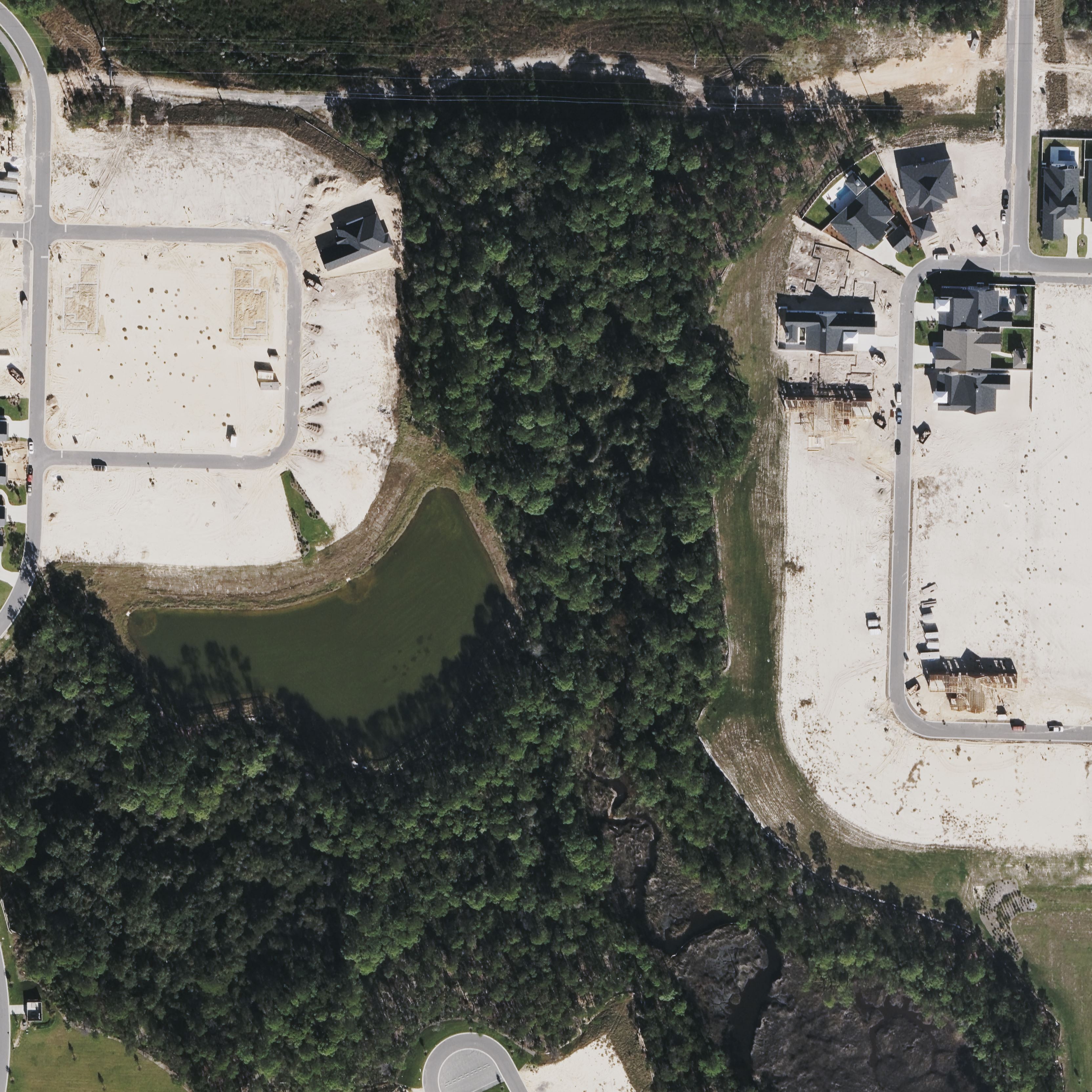
Bing aerial has higher detail (0.065 m/px) for this location.
Layers
Click a layer name below to select it for transform controls.
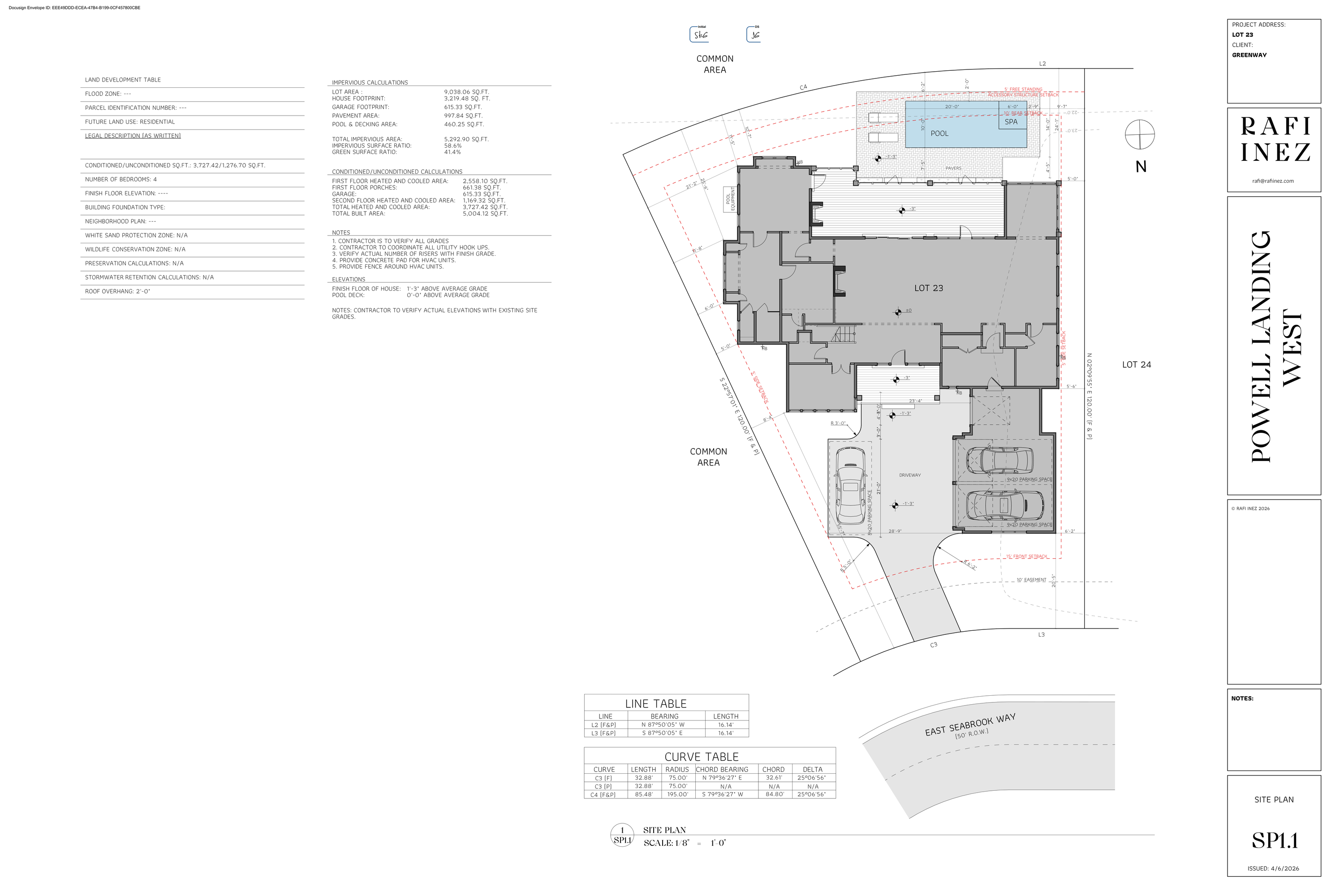
Arkon Site Plan
edit
100%
20
0°
400
400
Recorded Plat
edit
100%
30
0°
500
500
View
100%
Mouse wheel to zoom, drag background to pan.
Cursor
Move cursor over map…
Parcel Info (Parent Tract)
25-3S-18-16000-001-0000
Owner: ST JOSEPH LAND & DEV
Parent tract: 380.0 acres (16,553,671 sq ft)
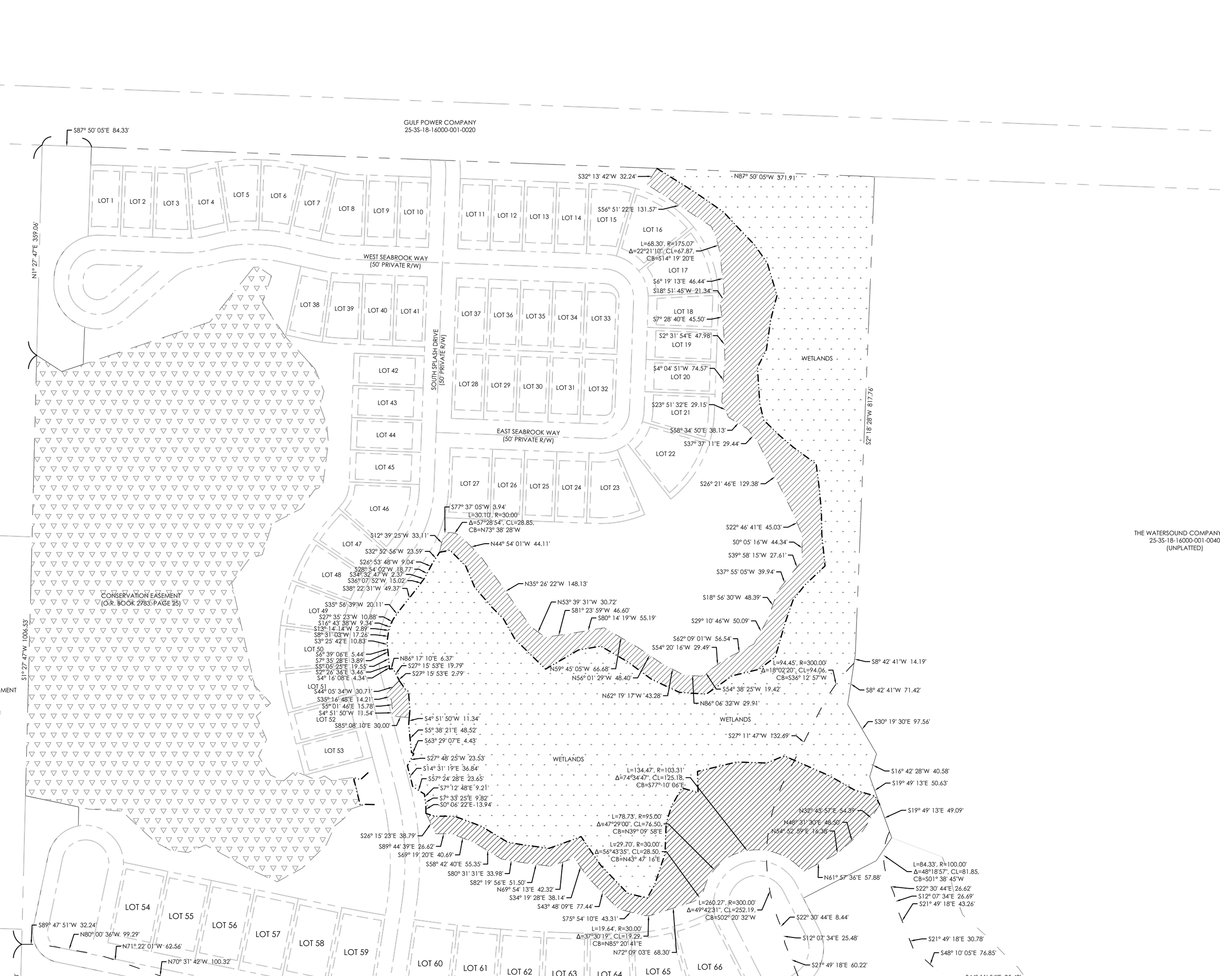
Lot 23 was subdivided in Powell Landing Phase 1A (plat lots 1–17, 38–53 replatted).
Owner: ST JOSEPH LAND & DEV
Parent tract: 380.0 acres (16,553,671 sq ft)
Lot 23 was subdivided in Powell Landing Phase 1A (plat lots 1–17, 38–53 replatted).
FL DOR statewide parcels still shows the parent St Joe tract. Lot 23 dimensions come from the recorded plat PDF + Arkon SP1.1 site plan.
Actions
Positions auto-save to your browser.
How to Align
1. Start with the plat. Toggle "Recorded Plat" on — it shows Lot 23 in its surveyed context with both Seabrook Ways.
2. Match road centerlines. Rotate + scale the plat so West/East Seabrook Way overlap the roads in the Bing aerial.
3. Overlay site plan. Switch to "edit Arkon Site Plan" and align the lot boundary on SP1.1 to the matching lot on the plat.
4. Fine-tune. Drop opacity to ~40% to see everything together.